
Space Coast Record Flood: Brevard Under Water
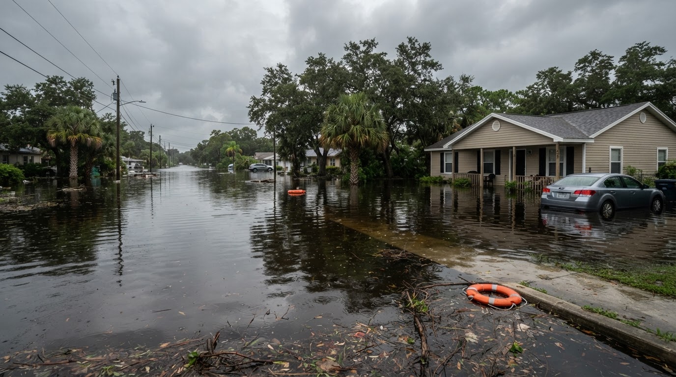
Brevard County faces a rare Level 4 flash flood risk Thursday with record river levels, water rescues and a shelter open. Who is affected and what to do now.
This article contains affiliate links. If you buy through these links, we may earn a small commission at no extra cost to you.
The Space Coast went from flood watch to record flood in one night. Shortly before noon on Thursday, the Weather Prediction Center raised far eastern Central Florida including Brevard County to a High risk of excessive rainfall, its highest tier, through Friday morning. By then the damage was already done: 6 to 10 inches of rain had fallen across central Brevard, about 15 inches over Port Canaveral, and the St. Johns River near Cocoa had blown past a record that stood since 1953. Read the Melbourne forecast discussion for the latest reasoning, and the National Weather Service flood safety page for the official rules behind every step below.
This is the sharp end of the same wet pattern behind our Florida flood watch coverage from Tuesday. South Florida took its turn Wednesday with more than a foot of rain on Broward County. Thursday belongs to Brevard, and the numbers there now stand on their own.
Who is affected and when
Thursday morning brought warnings for nearly the whole county. The central zone of Titusville, Cocoa, Rockledge, Merritt Island, Viera and the beaches reported 6 to 10 inches. The southeastern zone around Palm Bay and Melbourne ran 3.5 to 8 inches, and emergency management reported parts of Port Malabar Boulevard washed away and closed. Melbourne asked everyone who could to stay home after police spent the morning pulling stuck cars out of flooded intersections.
The river tells the slower story. The St. Johns near Cocoa stood at 18.1 feet at 8:15 Thursday morning, well above its 16-foot flood stage and past the 17.6-foot record. Forecasters expect roughly 18.4 feet. At these levels water gets into homes along the river in the Lake Poinsett area west of Cocoa, low homes in the Silver Pines subdivision in Rockledge and the Shakespeare Park area of Cocoa, and the Providence Road area west of Cocoa turns impassable. The current NWS flood warning text carries the gauge readings and road impacts as they update.
More rain comes tonight. A Flood Watch runs through Friday evening with another 2 to 4 inches possible on ground that has nowhere to put it. The state is sending hundreds of Guard personnel, 200-plus troopers and 235 wildlife officers; Brevard schools and Florida Tech closed Thursday and Titusville declared a local emergency.
If you are in Brevard today
Stay off the roads if you have any choice. Floodwater hides debris, open drains and downed lines, and the wakes that passing trucks throw push water into homes that might otherwise stay dry. The rule has not changed: six inches of moving water can knock an adult down and a foot can carry a car. Never drive through a flooded road or around a barricade. Turn around, do not drown.
If water is rising toward you, move to higher ground early. If officials tell you to leave, go. The county shelter at the Walter Butler Community Center in Cocoa takes the general population, people with medical needs, and pets. Bring bedding, medicines, clothes, sturdy shoes, hygiene items and chargers. If you are trapped in a building, take the highest floor and call for help rather than wading through current you cannot read.
Keep one radio that does not need the cell network. Alerts go out at night and coverage drops near the coast at the worst moments, and a weather radio with alert tones wakes you when a phone on silent will not.
Midland GXT1000VP4 GMRS Two-Way Radios (pair)
Charge everything while the grid holds: phones, battery banks and rechargeable lights, because a long night of alerts drains the family phones fast. The Anker 10,000mAh bank at about $25.99 covers several full phone charges when the outlets go dark.
Anker Power Bank 10,000mAh USB-C
Go easy on the drains. The county asked residents to limit water use because flooding strains the wastewater system. Keep showers short, run full loads only, and hold what can wait until the system catches up.
Sandbags, barriers and the rooms that flood first
Palm Bay residents lined up for sandbags all week, and Thursday proved them right. A half-full stack laid like brickwork across doorways diverts the first inches, which are often the inches that ruin floors. Our sandbag stacking guide shows the layout that holds. A 50-pack of empty woven bags runs about $20.99; fill them with local soil and reuse them every storm.
Empty Sandbags 14x26 in Woven Poly with Ties, 50…
Put an early-warning ear in the lowest room. A small water alarm near the sump pit, water heater or washer sounds off at the first inch, which can save the drywall. Our flood safety guide covers the full before, during and after sequence in one place.
The Basement Watchdog 110 dB Water Alarm (BWD-HWA)
Stage a grab kit even if you do not evacuate: water, no-cook food, medicines, flashlights, chargers, pet supplies and cash in small bills. Our flood emergency kit checklist lists the whole loadout with quantities.
After the water drops
Wait for the official word before going home, then photograph everything before you clean. Stay out of floodwater, keep children and pets clear, and wear gloves and boots. Dry the house within 24 to 48 hours, toss food that touched floodwater, and file flood insurance early since homeowner policies exclude flooding. Our insurance and documentation walkthrough shows the 20-minute inventory that smooths the claim.
The weekend adds more water to soaked ground
A low near the northern Bahamas builds Friday and lifts north over the weekend, and forecasters give it about a 50 to 60 percent chance of becoming Subtropical Storm Kyle. The name does not matter for Brevard. What matters is another round of rain on soil that already set a river record, with the threat reaching Georgia and the Carolinas just as Thanksgiving travel peaks. Our Kyle tracking article covers the weekend system and the travel impacts. Keep the sandbags staged, the kit packed and the radio where you can hear it until this pattern finally breaks.
Frequently asked questions
Which parts of Brevard are flooding?
Central Brevard took the worst of it: Titusville, Cocoa, Rockledge, Merritt Island, Viera and the beaches, with 6 to 10 inches reported and about 15 inches over Port Canaveral. Southeast Brevard including Palm Bay and Melbourne also flooded, and the St. Johns River near Cocoa passed its all-time record.
How high will the St. Johns River go?
The gauge near Cocoa read 18.1 feet Thursday morning against a 1953 record of 17.6 feet, and forecasters expect about 18.4 feet. At these levels water enters homes near Lake Poinsett, Silver Pines in Rockledge and Shakespeare Park in Cocoa. Check the current river statement before you travel near the river.
Where is the emergency shelter?
Brevard County opened a shelter at the Walter Butler Community Center, 4201 N. Cocoa Blvd. in Cocoa. It takes the general population, people with medical needs, and pets. Bring bedding, medicines, clothes, hygiene items and something to pass the time.
Will the weekend storm make it worse?
Probably, at least a little. A low near the Bahamas may become Subtropical Storm Kyle as it moves north, and it throws more rain at ground that cannot absorb any. Even areas that drain by Friday should keep sandbags and kits staged through the weekend.