
Coastal Storm Kyle May Snarl Thanksgiving Travel
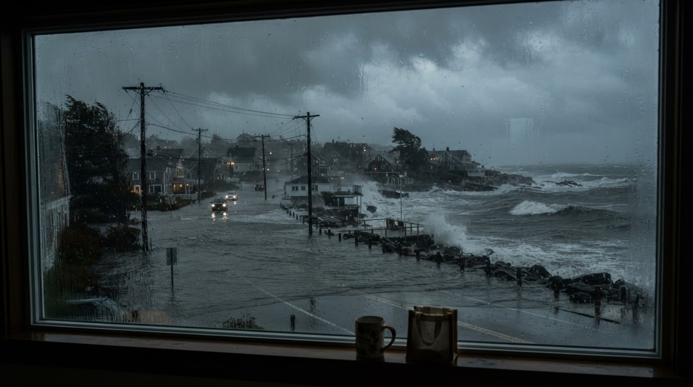
A Southeast low may become Subtropical Storm Kyle this weekend, with heavy rain and coastal flooding from Florida to New England as Thanksgiving travel peaks.
This article contains affiliate links. If you buy through these links, we may earn a small commission at no extra cost to you.
A coastal low forming near the northern Bahamas late Friday could grow into something with a name by the weekend, and millions of Thanksgiving travelers are in its path. The National Hurricane Center says the system may take on subtropical or tropical characteristics as it moves north or northeast near or offshore of the Southeast coast. Formation odds sit near zero over 48 hours and rise to 50 percent over seven days. If it strengthens enough, it becomes Kyle, the next name on the 2026 Atlantic list. Read the current Tropical Weather Outlook before making weekend plans.
Here is the part that matters more than the name. The Hurricane Center expects strong winds, dangerous surf, and coastal flooding along parts of the Southeast and mid-Atlantic coasts into early next week regardless of development. The Weather Prediction Center carries a Level 2 of 4 flash flood risk for South Carolina, Georgia, and northeast Florida starting Saturday, with the rain shield reaching North Carolina to Philadelphia and southern New Jersey by Sunday and possibly brushing the Northeast on Monday. If you travel Monday through a big Northeast airport, build in time for weather delays. Our hurricane safety guide covers the full before, during, and after playbook for exactly this kind of hybrid storm.
Florida is already soaked, which is why this setup deserves respect. Broward County and Fort Lauderdale both declared local states of emergency Wednesday after overnight downpours dropped more than a foot of rain on Hollywood and Plantation, with isolated reports above 15 inches. Schools, courts, and government offices stayed shut Thursday, sections of I-95 and the Turnpike closed, and flood watches run through Thursday evening. The Space Coast faces a moderate risk of excessive rain with another 3 to 6 inches and local 8-inch totals possible. Ground that wet cannot absorb much more, so even the fringe of the weekend system can pond roads fast. See the NWS flood safety page and Ready.gov floods for the official rules behind every step below.
Who gets what, and when
- Friday: The low takes shape near the northern Bahamas. Florida's east coast sees repeated showers and storms with gusty northeast winds, high surf, and life-threatening rip currents. Stay out of the ocean along the whole coast.
- Saturday into Sunday: The main event shifts north. Heavy rain and gusty winds spread along the Georgia and South Carolina coasts, with flash flooding possible where bands stall. Coastal erosion and overwash threaten beaches and low roads at high tide.
- Sunday into Monday: Rain reaches eastern North Carolina toward Philadelphia and southern New Jersey. Forecast tracks then split: a track hugging the coast brings stronger winds and wider rain into the mid-Atlantic, while an offshore track keeps the worst over water but still delivers surf and tidal flooding. Either way, Monday air travel in the Northeast can feel it.
What to do today, Thursday
Charge everything while the grid is normal. Top off phones, battery banks, laptops, and rechargeable lights, and keep one bank in the bag you carry, not in a suitcase you might gate-check. Anker Power Bank 10,000mAh USB-C The Anker 10,000mAh bank at about $25.99 refills a dead phone several times.
Lock in your travel backup plan before Friday. Screenshot or print boarding passes, hotel confirmations, and the airline rebooking number. If you drive, fill the tank and check the spare, the washer fluid, and the phone mount. Put water, snacks, medicines, a flashlight, and a blanket where you can reach them without opening the trunk in the rain. Our car emergency kit guide lists the full loadout. RESQME Original Emergency Keychain Car Escape Tool The RESQME cutter and glass breaker at about $10.95 clips to a keychain and belongs on every driver in flood-week traffic.
Dress for standing water, not for the forecast photo. A cheap shell that packs small beats a heavy coat you leave in the car. Frogg Toggs Ultra-Lite2 Rain Jacket (Men's) The Frogg Toggs Ultra-Lite2 at about $27.99 stuffs into its own pocket and keeps you dry through a parking-lot sprint or a terminal-to-rideshare dash in sideways rain.
If your street ponds, stage the barrier this afternoon. Half-fill sandbags and stack them like brickwork across the doors and garage entries that always take water first, with plastic sheeting behind them. Empty Sandbags 14x26 in Woven Poly with Ties, 50… A 50-pack of empty woven bags at about $20.99 fills with local soil and covers the openings that matter. Our sandbag stacking guide shows the layout that holds. Move rugs, papers, and anything that cannot get wet to a higher shelf now, while it is dry and calm.
If you travel into it this weekend
Do not drive through standing water, full stop. Ready.gov notes six inches of moving water can knock a person down and a foot can sweep a vehicle away. Turn around, take another road, or wait somewhere safe. Most flood deaths happen in cars. Never go around a barricade: the road beyond it is closed because it failed somewhere you cannot see.
Fly like you might get stuck. Keep medicines, chargers, a water bottle, snacks, and one change of clothes in your personal item. If your connection tightens, ask about rebooking before the delay posts, when agents still have seats to give.
Listen to the water even inland. Tidal flooding arrives at high tide with no rain falling on you, and it closes causeways and beach roads first. If officials order an evacuation for a barrier island or low-lying zone, go early. Traffic only gets worse as the water rises. Our flood safety guide walks the evacuation decision step by step.
Keep a grab kit by the door whether you stay or go: drinking water, food that needs no cooking, medicines, flashlights, phone chargers, pet supplies, and cash in small bills. Our flood emergency kit checklist has the quantities. If tap pressure drops or officials issue a boil notice during the storm, boil for a full minute or switch to bottled water until they lift it.
One last habit for the week. Verify before you share. Storm weeks breed old flood videos passed off as live and fake aid links that harvest card numbers. Check the Hurricane Center, your local Weather Service office, and your county emergency page, type addresses yourself instead of tapping message links, and send the family the forecast, not the rumor.
Frequently asked questions
Will this become Subtropical Storm Kyle?
Maybe. The Hurricane Center gives the low near the Bahamas a near-zero chance of developing within 48 hours and a 50 percent chance over seven days. The winds, surf, and flooding arrive whether or not it gets a name, so prepare for the impacts, not the label.
Which days are worst for travel?
Saturday and Sunday along the Georgia and Carolina coasts, spreading to North Carolina, the mid-Atlantic, and possibly the Northeast on Monday. If you fly Monday out of a Northeast hub, check your flight before leaving for the airport.
I live on the Florida east coast. Is this a second storm?
It is the same pattern continuing. Flood watches already run through Thursday evening in southeast Florida after 14-plus inches fell on Broward County. This weekend system adds more rain on soaked ground, then carries the threat north.
What is the one thing to do today?
Charge everything and pack like you might sleep somewhere unplanned: phone, charger, medicines, snacks, water, and a flashlight in the bag that stays with you, not in checked luggage or the trunk.